


What is “Fuji City Route 3776?”
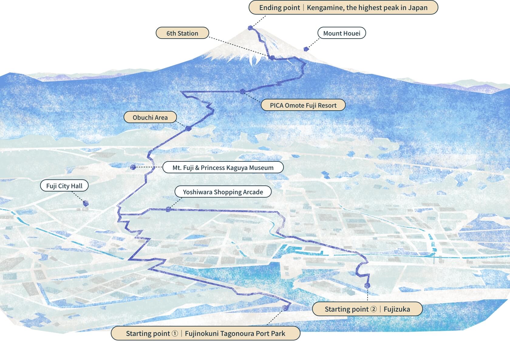
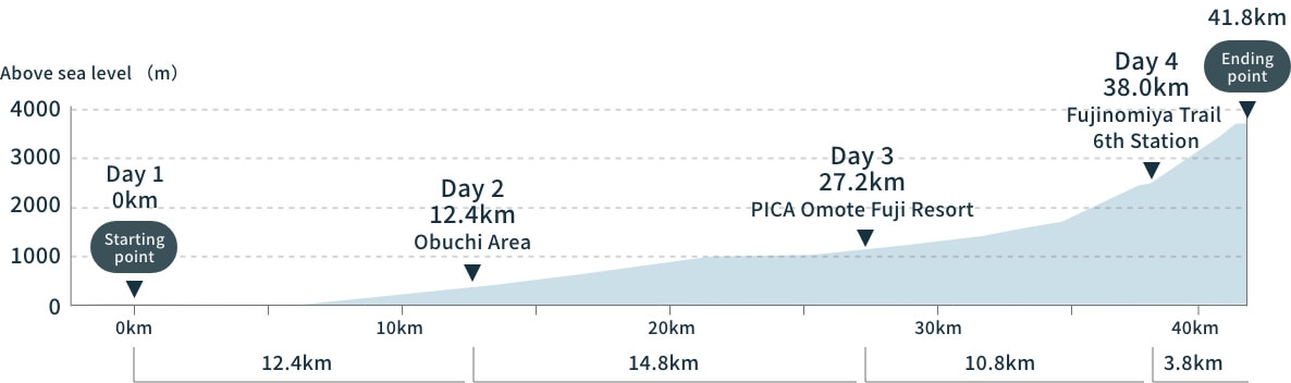
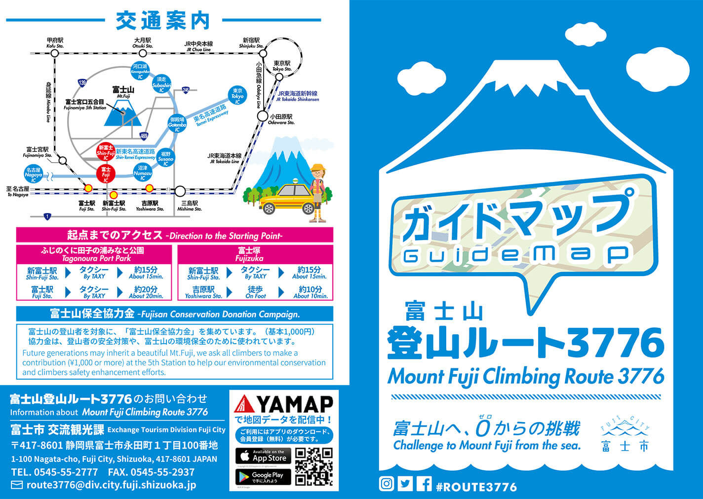
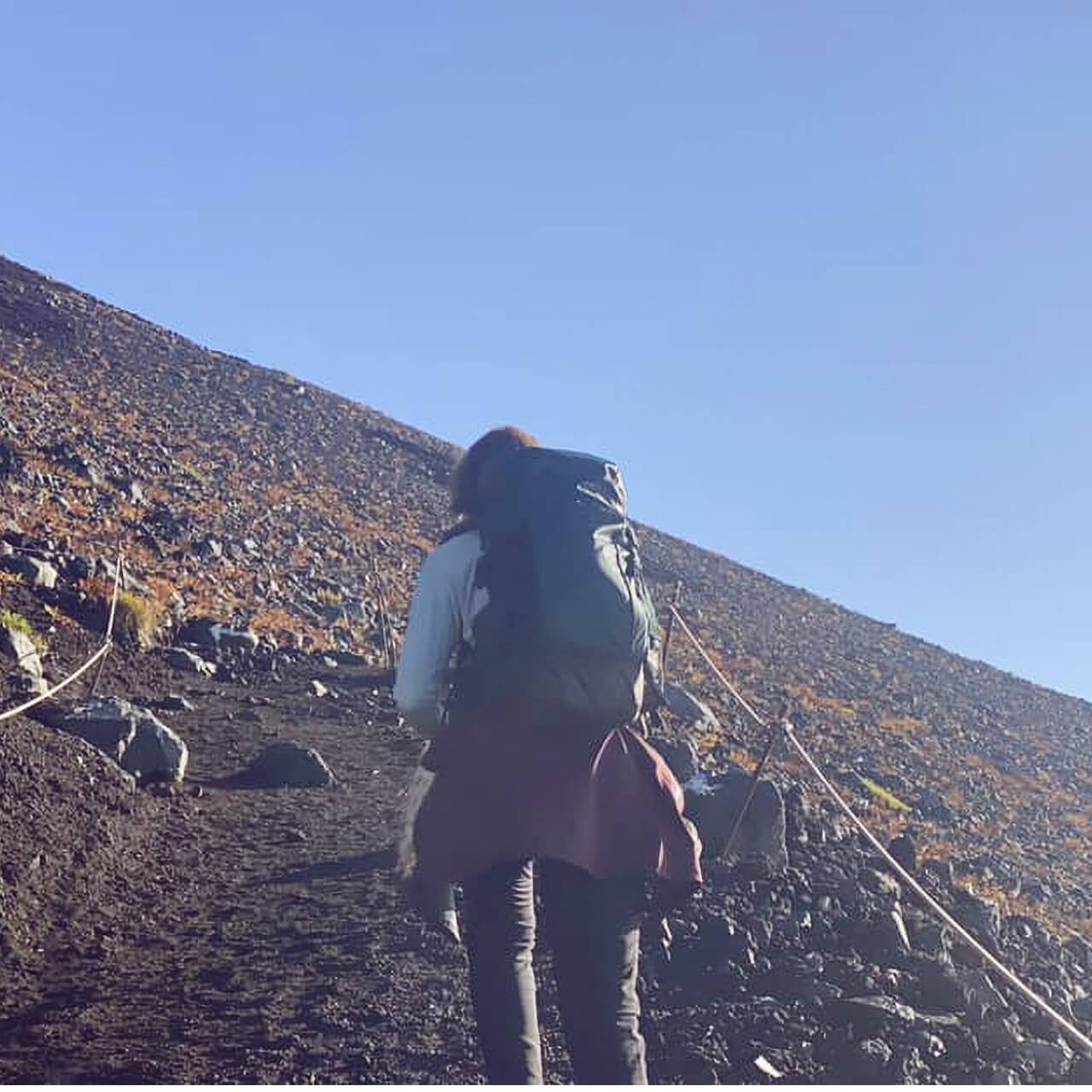
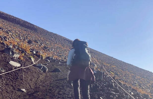
“Mount Fuji Climbing Route 3776” is a mountain-climbing route established by Fuji City that stretches about 42 km from the sea to the top of Mount Fuji (which has an altitude of 3,776 m).
This route is packed with one-of-a-kind appealing elements that can only be enjoyed there,
from panoramic views of Mount Fuji from all angles and the history of climbing the mountain from the sea established by the many pioneers who made that trek
to the tourism and industry resources formed by the natural blessings that Mount Fuji and Suruga Bay represent.
All of Fuji City warmly welcomes people who look to take on the challenge of Mount Fuji Climbing Route 3776.
About
Mount Fuji Climbing Route 3776: Overview
- Total length Total length:
- Approx. 42 km
- Starting points Starting points:
-
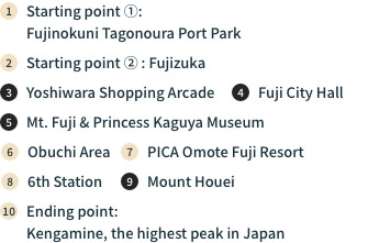
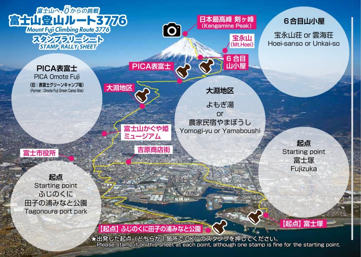
①Fujinokuni Tagonoura Port Park
②Fujizuka
- Ending points Ending points:
- Top of Mount Fuji (altitude of 3,776 m)
- Recommended itinerary Recommended itinerary:
- 3 nights, 4 days
Sectional Drawing of “Mount Fuji Climbing Route 3776”
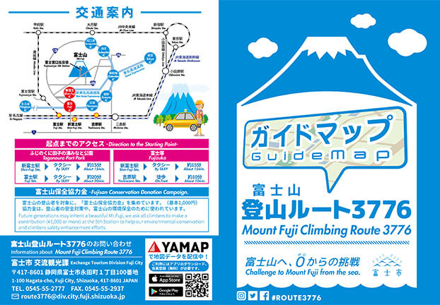
Guide Map
About This Guidemap
For details on Mount Fuji Climbing Route 3776, please see the Guidemap. This Guidemap is available in stamp boxes at the route starting points of “Fujinokuni Tagonoura Port Park” and “Fujizuka” as well as at the Shin-Fuji Station Tourist Information Center and the Exchange Tourism Division on the fifth floor of Fuji City Hall, among other locations.
Items Prepared in the Stamp Box at Starting Points
- Stamp
- Guidemap
- Stamp Rally Sheet
- Challenger identification sticker
-
Challenge PlanSubmit in the plan box set up next to the stamp box
- Leaflet
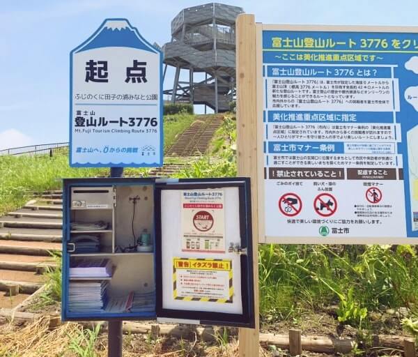
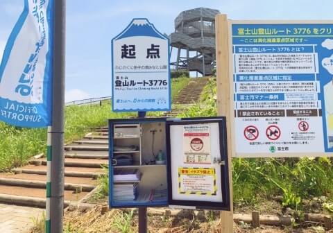
Starting point stamp box
at Fujinokuni Tagonoura Port Park
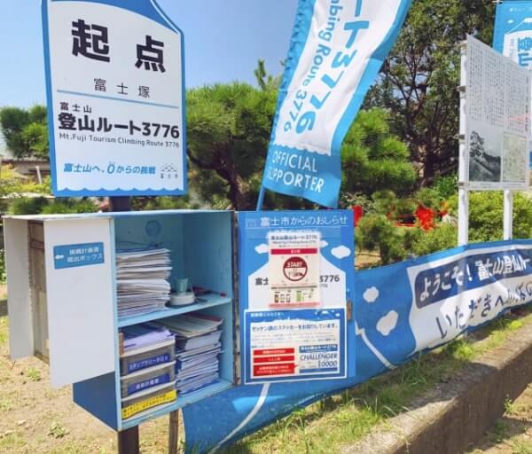
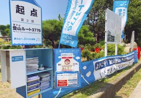
Starting point stamp box
at Fujizuka
In some cases, stock of pamphlets in the starting point mailbox may run out during weekends, the Obon holiday season, and other times when there are numerous challengers. Please request to have a Guidemap sent to you by regular mail or use the electronic stamp rally.
Challenge Plan
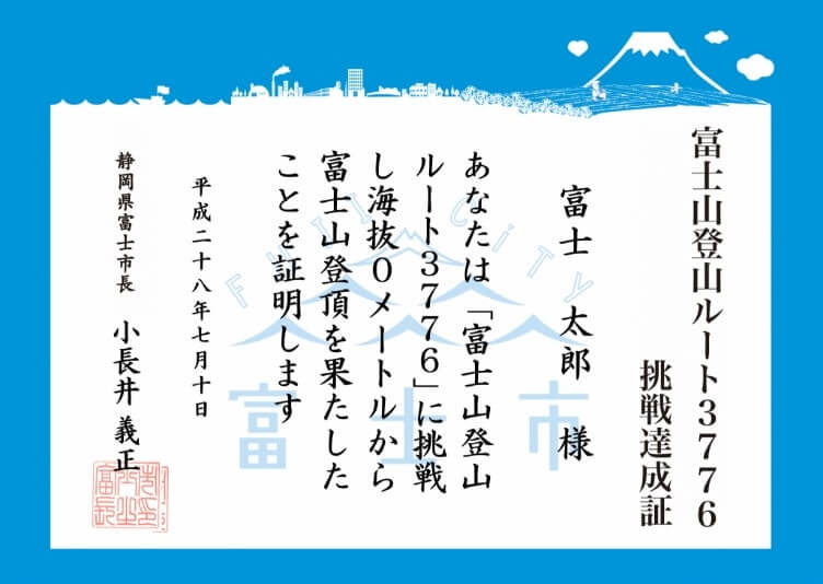
Finisher’s Certificate
(Presented to challengers who submitted a Stamp Rally Sheet and Challenge Plan)
About the Challenge Plan
Finisher’s Certificate
(Presented to challengers who submitted a Stamp
Rally Sheet and Challenge Plan)
“Mount Fuji Climbing Route 3776” is a mountain-climbing route that stretches about 42 km. It is recommended that you traverse the route over an itinerary over three nights and four days.
In order to tackle the challenge of this course safely, please take a look at the “Seven Challenger’s Rules” before submitting your “Challenge Plan.”
Should you submit a “Challenge Plan” and “Stamp Rally Sheet” and finish climbing the mountain starting from the sea, you will be issued a “Finisher’s Certificate.”
Stamp Rally
About the Stamp Rally
The “Route 3776 Stamp Rally” makes Mount Fuji Climbing Route 3776 even more fun.
Challengers who successfully complete the stamp rally will be presented with a Finisher’s Badge. Those who submitted a Challenge Plan in advance will also be issued a Finisher’s Certificate.
Path to Obtaining a Finisher’s Badge
STEP 1
Obtain a “Route 3776 Stamp Rally Sheet.”
STEP 2
Affix the stamp at
each point onto the sheet.
STEP 3
Take a photo of the
top of Mt. Fuji.
STEP 4
Use the application form to send the Stamp Rally Sheet
and your photo of the top of Mt. Fuji.
You can also send the sheet affixed with your photo by
regular mail with an 84-yen stamp.
STEP 5
The Fuji Municipal Government will check your Route 3776
Stamp Rally Sheet and award certified challengers
with a Finisher’s Badge.
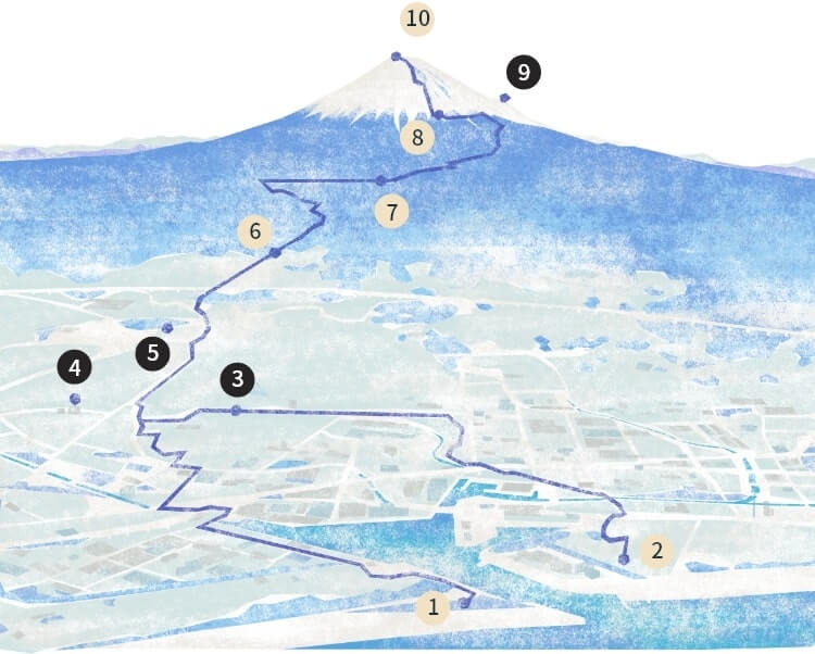
Stamp Point
-
1
Starting point
(One of the points to the right) -
- Fujinokuni Tagonoura Port Park stamp box
- Fujizuka stamp box
-
2
Obuchi Area
(One of the points to the right) -
- Yomogi-yu stamp box
- Yamaboushi Farm Inn
- 3PICA Omote Fuji Resort
-
- PICA Omote Fuji Resort stamp box
-
4
6th Station mountain huts
(One of the points to the right) -
- Hoei-sanso
- Unkai-so
- 5 Top of Mount Fuji
-
*There is no stamp available here (Electronic stamp excluded). Please take a photo of the top of Mount Fuji and send it through the application form or via regular email by attaching it to the sheet.
- Stamp boxes are placed outside, and can be accessed any time 24 hours a day.
- For the stamps at Yamaboushi Farm Inn and the 6th Station mountain huts, please ask the staff of the applicable facility.
During non-business hours, when in the Obuchi Area, please use the Yomogi-yu stamp box. When at the 6th Station, please write “Non-business hours” on the stamp spot.
You can also participate in the stamp
rally through electronic means.
An electronic version of the stamp rally using the smartphone app “COCOAR” is also available.
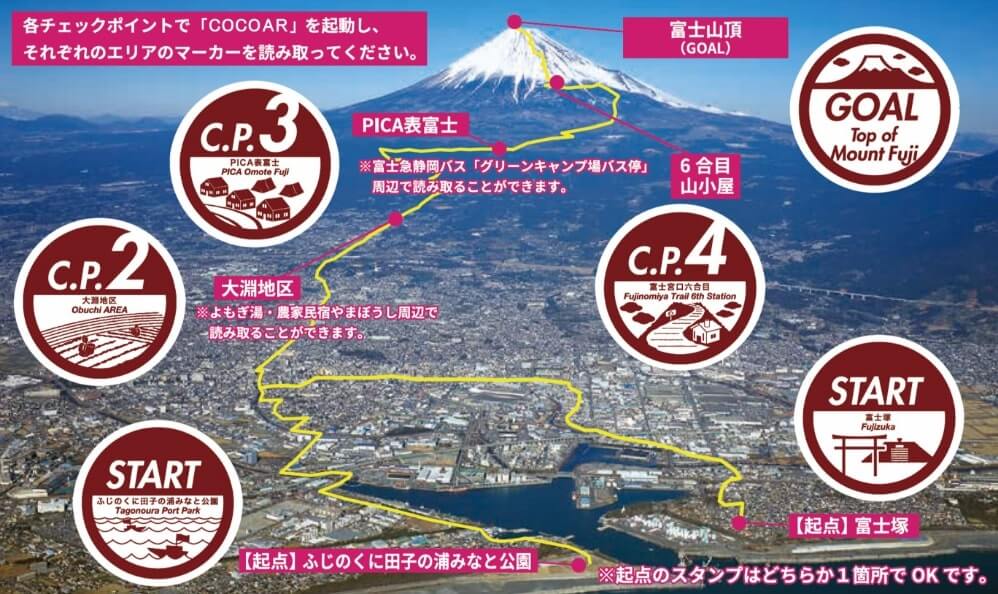
Marker (stamp mark) at each area
- Download the app onto your smartphone
-
Boot up “COCOAR” at each checkpoint
and use it to scan the marker (stamp mark)
at each area. -
After you have gathered five stamps,
report that you have finished the stamp rally
on your smartphone screen.
- You will receive an electronic stamp once the app has recognized data on your location and you have scanned a marker (stamp mark).
- The marker (stamp mark) is displayed in the Guidemap and on the applicable stamp box.
- Download the app onto your smartphone
-
Boot up “COCOAR” at each checkpoint
and use it to scan the marker (stamp mark) at each area. -
After you have gathered five stamps,
report that you have finished the stamp rally on your smartphone screen.
- You will receive an electronic stamp once the app has recognized data on your location and you have scanned a marker (stamp mark).
- The marker (stamp mark) is displayed in the Guidemap and on the applicable stamp box.
YAMAP
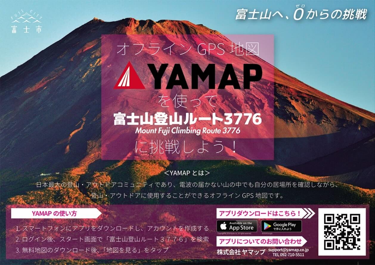
Please use the offline GPS map
“YAMAP.”
“YAMAP” is one of Japan’s largest mountain-climbing and outdoor communities. This offline GPS map can be used during mountain-climbing and outdoor activities while verifying where you are even in parts of mountains where no signal is available.
To accommodate the needs of challengers who want accurate routes on Mount Fuji Climbing Route 3776 provided in electronic data form, an electronic data map that can be verified using a website or smartphone app has been prepared. This is delivered through the “YAMAP” mounting-climbing app.